

| Общая информация |
Исмаиллинский район находится на севере республики, у южного подножья Больших Кавказских гор на расстоянии 185 км. от г.Баку.
Три из девяти климатических поясов Азербайджана представлены на территории Исмаиллинского района: умеренно теплый с сухой зимой, умеренно теплый с равномерным распределением осадков (на равнинах) и холодный с влажной зимой в горах.
Ландшафт региона в основном - гористый. Природа здесь очень красивая, горы поросшие лесом, скалы, реки, водопады, высотой до 50 метров. Есть три естественных озера на высоте 3500 м., рядом с горой Бабадаг, которые не только красивы, но и представляют отличное место для рыбалки. На территории района находится заповедник "Исмаиллы", где представлено более 40 видов деревьев и кустарников и водятся 170 видов животных, включая оленей, горных козлов, кабанов, медведей, волков, лис, зайцев и т.д.
Район специализируется на земледелии, виноградарстве и животноводстве. Наличие большого количества летних пастбищ (яйлагов) и зимовок (гышлагов) позволяют получать хорошие результаты в заготовке мяса и шерсти овец. Промышленность района, главным образом, представлена такими отраслями, как виноделие, плодоводство, швейная отрасль и ковроткачество.
Исмаиллы является частью исторического Ширвана. Территория района, как и все территории Северного Азербайджана, еще в IV столетии входила в состав Кавказской Албании. Исмаиллы также один из центров виноделия в Азербайджане и здесь имеются все возможности для такого направления туризма – как винные туры. Например, гости могут остановиться в отеле комплекса «Шато Монолит» (Shato Monolit) и одновременно посетить винодельческое хозяйство полного цикла, от выращивания винограда до розлива вина в бутылки.
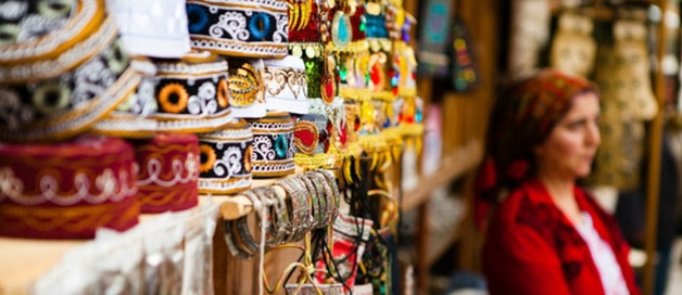
В свою очередь, будучи центрами ремесленничества - поселок Лагич, известен в народе медными изделиями, а село Баскал — своими келагаями (шелковыми платками). Традиционным видом ремесла для большинства других сел является ковроткачество.
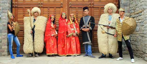
Исмаиллинский район этнографически очень разнообразен. Помимо азербайджанцев, здесь живут представители других народов и этнических групп. Например, в известном селе Ивановка живут потомки молокан, переселенных сюда из России. Местные жители очень трудолюбивы и сохранили свою давнюю культуру и традиции. А в расположенном на берегу реки Гирдиманчай селе Лагич, проживают таты, которые называют себя лагиджами и говорят на языке, близком к фарси.
| Лагич |
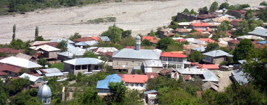
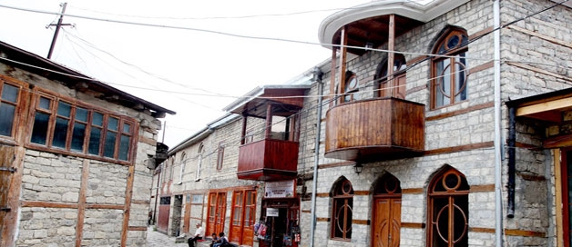
Лагич представляет собой уникальное историческое горное поселение-город ремесел и народных умельцев, и расположен на высоте 1505 метров над уровнем моря. Густые леса, скалы, бурлящие быстрые реки, хрустальные озера, водопады, богатая фауна-словом природа щедро одарила этот край. Именно здесь великий русский поэт М.Ю. Лермонтов, будучи на отдыхе, услышал дастан об ашуге Гарибе, положив его в основу своей одноименной поэмы. Сегодня Лагич, как и в прежние времена представляет собой этнографический уголок Азербайджана, где сегодня проживает не более 2000 человек, но где жители по-прежнему плетут языковое кружево на своем уникальном фарсидском (иранском) диалекте.
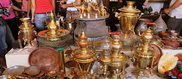
Проезд до селения Лагич является запоминающимся на долгое время, когда в извилистых дорогах перед туристами вдруг возникают великолепные по красоте пейзажи. Поселок формировался первоначально как центр по добыче, выплавке и обработке меди и других цветных металлов. В далеком средневековье он стал одним из значительных центров на всем Кавказе по изготовлению оружия, посуды, ковровых, гончарных и других изделий, создаваемых талантливыми мастерами-умельцами этого края. Жители этого древнего поселения сохраняют веками сложившийся уклад жизни и свои традиции. Экологически чистый горный край способствовал развитию здесь народной медицины, и сегодня, многочисленным туристам предоставляется возможность испробовать ледяную воду старинных городских родников, принять целебные ванны из вод минеральных источников, приобрести у местных пасечников настоящий целебный горный мед и эфирные масла.
| Достопримечательности |
На левом берегу реки Гирдыманчай, на вершине самой высокой горы сохранились руины средневековой крепости, создание которой связано с именем Джаваншира, повелителя Кавказской Албании (VII век). Башня Харам, замок Гырхотаг, Джума мечеть и стена Хиреки, оборонительного назначения в Сулуте также вызывают большой интерес. Однако самым знаменитым и значимым историческим памятником района является Девичья башня (VII-XII века), - оборонительное сооружение, находящееся на вершине крутой горы, недалеко от деревни Ханагях.
Инетересен для туристов также Историко-краеведческий музей в городе Исмайыллы
Небольшая ремесленная мастерская по производству шёлковых женских головных платков «Кялягаи» и музей в посёлке Басгал и др.
| Достопримечательности (Лагич) |
1. Краеведческий музей в здании старой мечети «Бядавун» в посёлке Лагыч
2. Мастерские ремесленников и небольшие магазины с антиквариатом в горном посёлке-заповеднике Лагыч
3. Небольшая ремесленная мастерская по производству шёлковых женских головных платков «Кялягаи» и музей в посёлке Басгал
4. Архитектурные памятники средневековья в посёлке-заповеднике Лагыч
- Мечети: «Бядавун» 1791 г., «Юхары Арагит» ХIХ в., «Ашагы Арагит» ХIХ в., «Заваро» ХIХ в.,мечеть «Хаджы Махмуд» ХIХ в.
- Бани ХIХ в.: «Хаджы Джаханбахыш хамамы», «Хаджы Нурмяммяд хамамы», «Аслани хамамы», «Хаджы Молла хамамы»
- Остатки 4-х этажного жилого дома «Хан эви» XVIII-XIX вв. и старинные жилые дома в различных жилых кварталах посёлка
- Аарочный мост «Лил кёрпюсю» ХIХ в.
- Водяная мельница ХIХ в.
5. Остатки средневековой крепости«Джаваншир галасы» (VII-XVI вв.) у посёлка Талыстан и развалины оборонительного сооружения «Гыз галасы» (VII-IX вв.) в ущелье реки Ах-Ох чай в районе посёлка Ханагя.
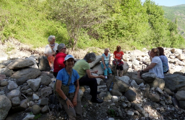
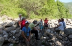
| Туры и экскурсии (Лагич) |
Предлагаем совершить экскурсии
1. Обзорная экскурсия по достопримечательностям Лагича и его окрестностей
2. Экскурсия в экзотический каньон реки Гирдманчай и в горный посёлок Лагич - древний центр ремесленного производства
3. Этнографическая экскурсия в места компактного расселения «Ширванских лезгин» в посёлках Сумагаллы, Истису и Галаджык
4. Этнографическая экскурсия в место поселения «Ширванских иудеев» – посёлок Мюджи-Хяфтяран
6. Экскурсия в посёлки Хаджи Хятямли /Гаджигатамлы / и Моллаисахлы в места компактного расселения этнографической группы - народа грызы,с посещением винного предприятия «Шато-Монолит»
7. Экскурсия к минеральному серному источнику «Бядо» в районе посёлков Зяргяран и Тирджан